|
|
|
Please
remember that there are two major factors that make it
imperative that we know where we are relevant to
"the step" ...
(a)
flying above 3,500 feet in the 3,500 feet ceiling area is a SERIOUS
and DANGEROUS violation of restricted airspace, and
(b)
if you are at or below 3,500 feet and you getting too far
out into the 4500 ft ceiling area, you are more than likely putting
your glider in an area outside of its "glide-back to
YCAB" range (particularly when the prevailing
wind means that you are fully or even partially downwind
from YCAB).
|
|
|
|
In
relation to (b), I can tell you from personal
experience that you can get caught out from well
within "the step".
|
|
|
|
Not that long
ago, I had to take a calculated decision to outland while solo in the IS-28
(into a
horse paddock about one nautical mile to the north east
of YCAB in a line straight off 06) ... and that was after feeling very
comfortable with my position and height (ie:
glide-back angle relative to YCAB) about half
way in from "the step" to the north east of
the Airfield only a few minutes earlier!
|
|
|
|
I had
suddenly and completely unexpectedly encountered a 360
degree wind direction change from NE to SE which had
me dealing with a strong headwind relative to YCAB as
well as heavy sink (when I had been in and
around the same area frequently during the flight "playing it
safe" with a reasonable tailwind relative to YCAB
as well as reasonably good lift).
|
|
|
|
Only minutes earlier,
when directly north of the field, I had
made a conscious decision to move further to the east
(upwind of the airfield) to allow "safety
space" for a powered aircraft after a radio chat
with its pilot (that had resulted from him
"calling" that he was coming over the airfield from
north to south while heading to Redcliffe at roughly the same AGL as
me).
|
|
|
|
This
could also happen to you!
|
|
|
|

|
|
---------------------------------------------------------------------------------
|
|
|
|
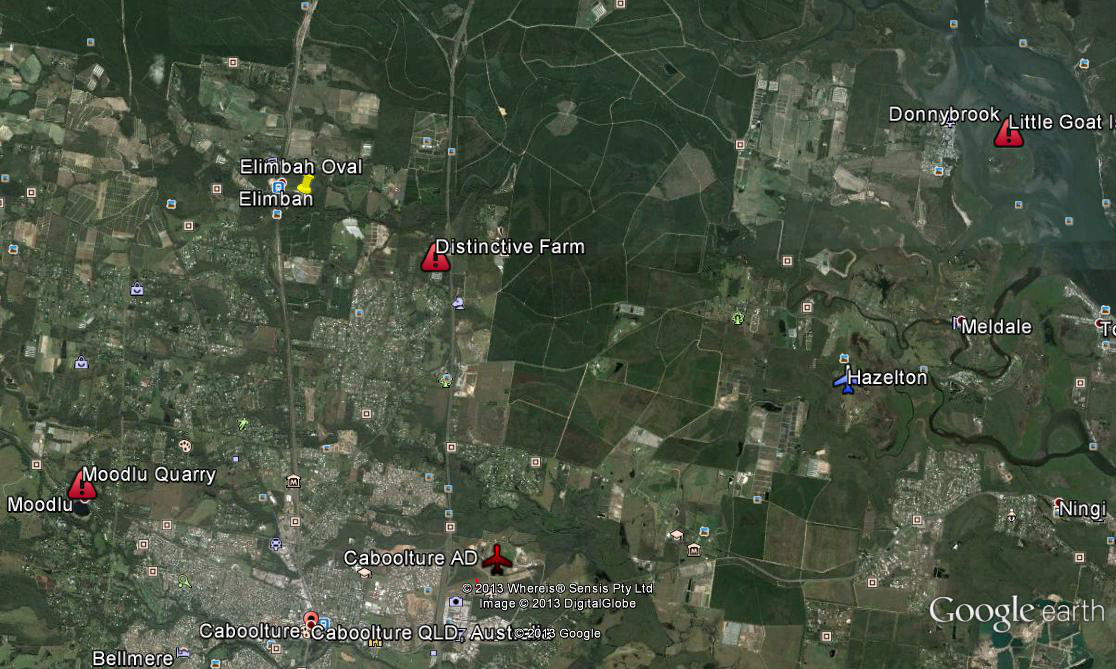
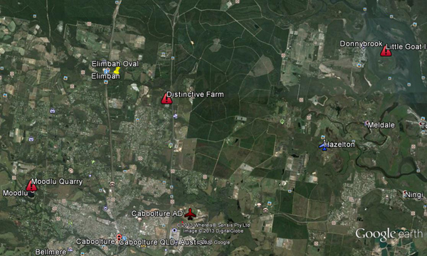
Below
are Google Maps images of the three main "on the
ground" reference points that I use
relative to "the step"
...
1)
Moodlu Quarry,
2)
Distinctive Farm with parallel sheds,
3)
Little Goat Island,
When
flying in a motor glider out over Bribie Island to
Moreton Bay, I also use ...
4)
Mermaid Lagoon
|
|
|
|
|
|
click on image for a larger view
|
|
|
|
|
|
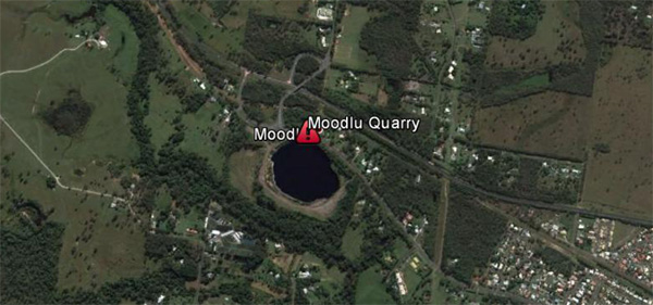
1)
Moodlu Quarry
...
to the
north west of Caboolture Golf Club
|
|
|
|
|
|
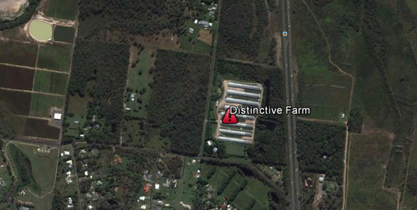
2)
Distinctive Farm with parallel east-west sheds -
north
of "Humble Pie" (which was "The Big
Fish") and to the
west of the Highway.
|
|
|
|
|
|
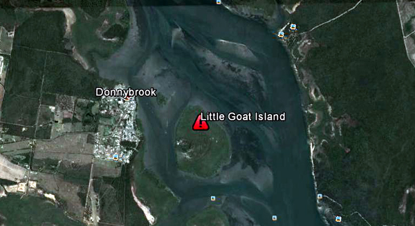
3)
Little Goat Island (the round island in
Pumicestone Passage to the east of Donnybrook).
|
|
|
|

|
|
Mermaid
Lagoon
- on the ocean side of Bribie Island seven kilometres to the north of the Bribie Island bridge.
|
|
|
|
---------------------------------------------------------------------------------
|
|
|
|
BEFORE
venturing out past "the step", please
discuss your intentions with the Duty Instructor.
He/she
will ensure that you are acutely aware of exactly where
"the step" is and how to identify from your
cockpit where you are relative to "the step"
(by reference to these landmarks).
|
|
|
|
Fly
safely,
|
|
|

|